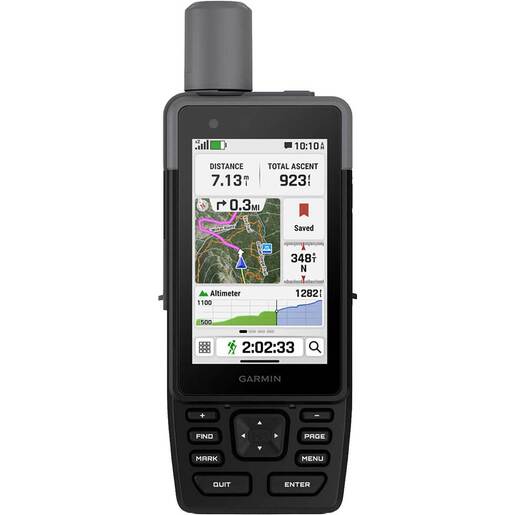
Garmin GPSMAP H1 Handheld GPS - This rugged GPS handheld navigator has a modern design, preloaded maps and incredible battery life. It’s time to hit the trails. Features Touchscreen Display - The bright, sunlight-readable 3.5-inch color touchscreen has chemically strengthened glass to resist scratches. It is glove-friendly, easy to see and easy to use. Tap, zoom and swipe on the maps to follow your route. Physical Buttons - The rugged hybrid design also features intuitive push buttons for more versatility when operating in weather and while wearing gloves. The quick-action button lets users customize functions to their specific needs. Advanced Navigation - Navigate with preloaded TopoActive maps for the U.S., Mexico and Canada and easy-to-access global maps. See terrain contours, elevations, geographical points and more. Satellite Imagery - Download high-resolution photorealistic maps directly to your device via Wi-Fi technology. Find trails, pick stand locations and parking, create waypoints and more. Outdoor Maps+ - Purchase an Outdoor Maps+ plan for access to a variety of premium mapping content across the globe. The subscription is updated regularly and sent to your device over Wi-Fi. Location Accuracy - Get multi-band GPS and multi-GNSS support for superior positional accuracy.